Site map - Satellite View
Our residents meeting exposed some uncertainty about which plots of land are being spoken about.
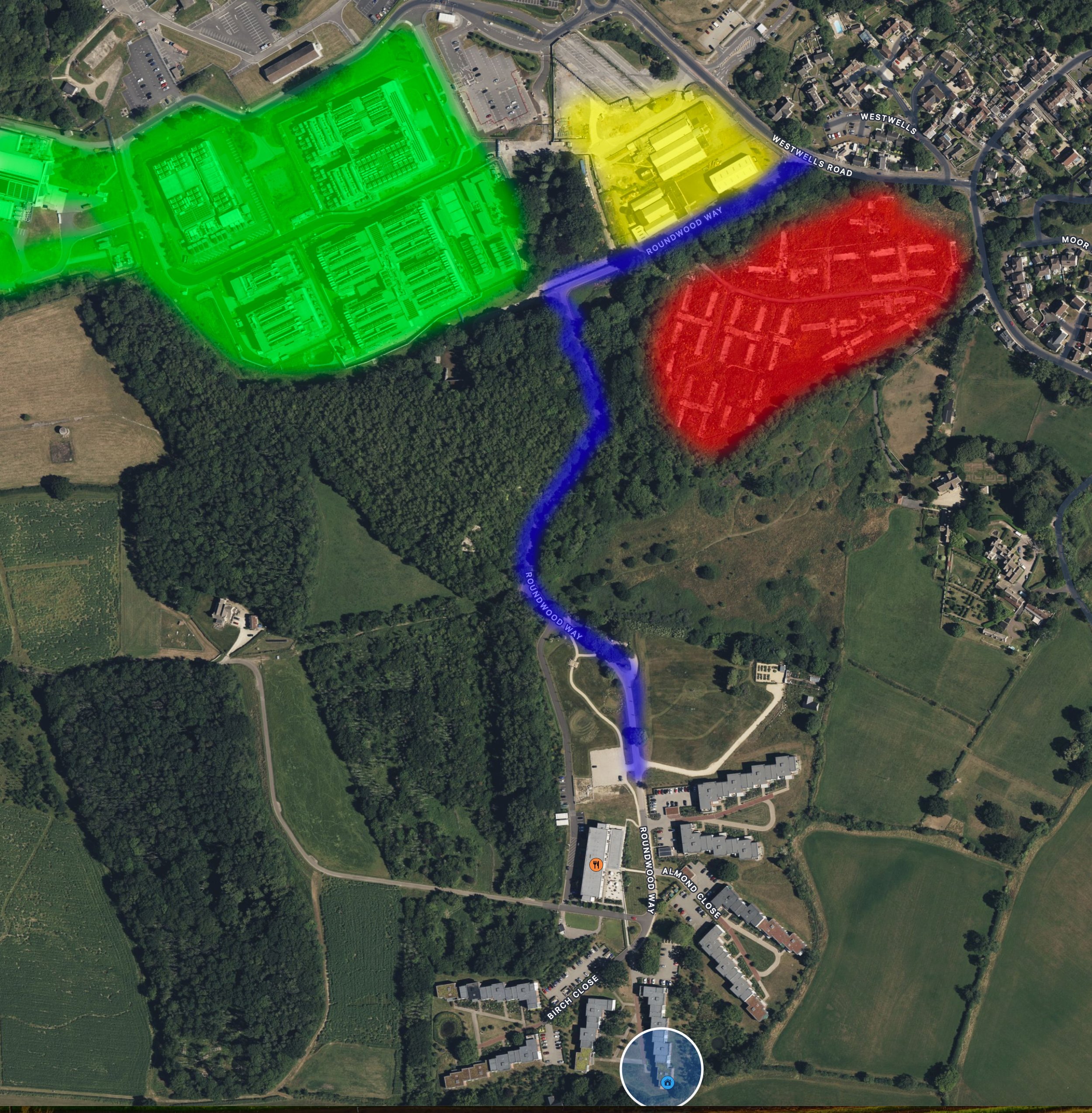
Apple Maps Satellite View of the area under consideration (see Key below)
Key
Blue line - the WG access road from West Wells. (Shown as Roundwood Way on this Map, shown as Rowan Lane on Google Maps and this is the name it is reffered to as in the application.
Green shading - the existing ARK Campus data storage buildings.
Yellow Shading - the approved but not yet built data centres, including the Stephens Industry site.
Red Shading - the area known as Sands Quarry or the Donkey field. The site of this latest planning application.
The collective area is known as “Spring Campus”. It is owned by a private company known as Ark Data Centres. Note their expansion from a secluded site within the MoD boundary shielded by trees and the old mine spoil heap around into Westwells and towards Wadswick Green.